Application of remote sensing images in environmental resources management includes: Land resources, water resources, mineral resources, forest resources, environmental monitoring are increasingly important for the State’s management, and influence Detective can take pictures in all the harsh conditions of the atmosphere.
Remote sensing image concept
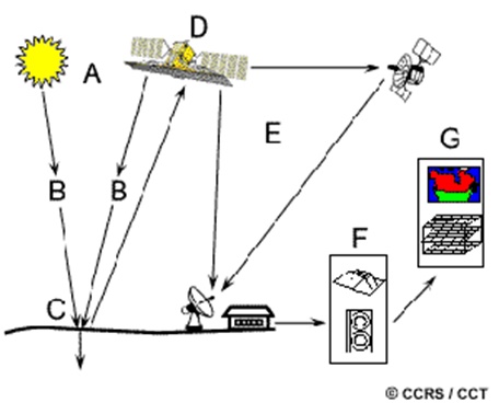 Remote sensing operation model
Remote sensing is the science of capturing and photographing all activities on Earth, which is the method of obtaining objective information about the surface of the earth and the phenomena in the atmosphere thanks to the sensors placed on aircraft, artificial satellites, space ships or placed on orbit stations.
The capacity of remote sensing technology in our country
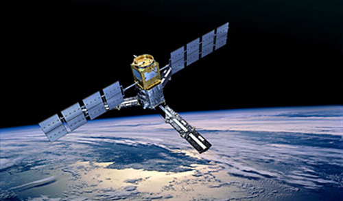 Remote sensing imaging technology
Application of remote sensing technology to monitor resources and the environment
Application of remote sensing technology to monitor natural resources and environment in our country in the past time, although some results have been obtained, but few, scattered and in fact have not met the demand.
The applications of remote sensing technology mainly focus on the field of adjusting topographic maps in remote sensing field survey, establishing a number of thematic maps, but Application of remote sensing image in land management and some aspects of the environment.
What do practical applications of telecom technology require?
This fact requires the widespread application of remote sensing technology for natural resource management and environmental monitoring. Enhancing the strength of remote sensing science applied to human life.
The construction of the System for Monitoring Natural Resources and Environment has opened a new development period of remote sensing technology. In the immediate future, satellite images will be collected at the popular remote sensing image receiving station mentioned above in order to meet the basic needs of remote sensing and GIS images for the sectors.
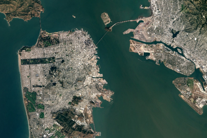
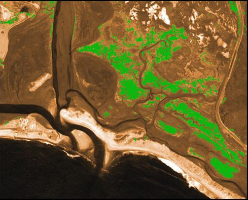
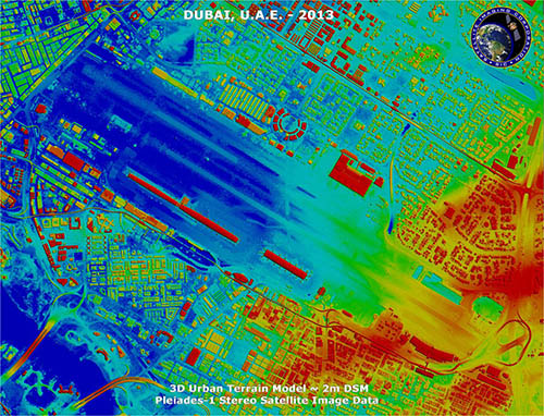
Photo taken from satellite remote sensing
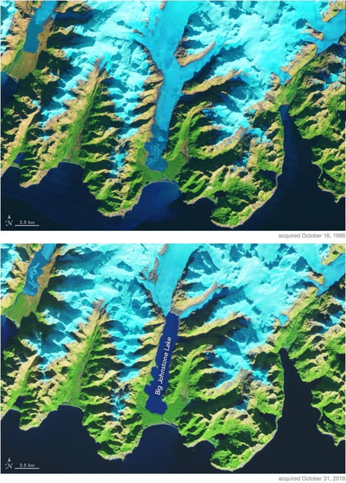
Actual results after a time using remote sensing technology
After a period of application, it will upgrade to acquire new high-resolution satellite that meet the increasing demand in many fields and in many economic sectors of the country.
That fact requires that the Center for Remote Sensing Data Processing & Analysis must promote the application of remote sensing technology for resource management and environmental monitoring on the basis of close coordination with relevant units in the and outside the Ministry.
Characteristics of remote sensing images
Remote sensing industry is a part of aerospace technology, although it has just been developed but has been quickly adopted in many fields and widely spread in developed countries.
Remote sensing technology has become the main vehicle for monitoring natural resources and the environment at the level of each country, region and the world.
The ability to apply remote sensing technology is increasingly enhanced, this is the reason for the popularity of this technology.
Remote sensing images have the following basic advantages:
Use application of remote sensing images in land resource management
– Space coverage of materials including information on natural resources and environment on a large area of the earth, including areas that are difficult to reach such as primeval forests, marshes and islands.
– Ability to monitor the changes of the earth’s natural resources and environment due to continuous and continuous monitoring cycles on the same object on the ground of remote sensing receivers. This capability allows remote sensing technology to record changes in natural resources and environment to help monitor and inventory natural resources and the environment.
– Using different spectral bands to monitor objects (object recognition), thanks to this ability remote sensing photographic data is used for a variety of purposes, including climate and thermal research. Earth’s degree.
– Rapid provision of high-resolution and ultra-high-resolution digital image materials, is the basic data for the establishment and revision of the national map system and national geographic database system.
With these advantages, remote sensing technology is becoming the key technology for managing and monitoring natural resources and environment in our country today.
Using remote sensing images to investigate and monitor land resources
Land resources have two types: Land cover and land use situation, to investigate and monitor these two aspects, at different levels, can apply remote sensing technology.
So far in the country, satellite images have been used by many agencies in our country to establish land use status maps. These maps cover territories ranging from narrow areas to provinces, regions and the nation.
So far, many agencies in our country have used satellite images to establish the current land use map to serve different purposes, using satellite images to investigate and establish the current status map. systematically use the land.
In terms of soil, satellite images can be used in the investigation and establishment of soil maps, research and monitoring of soil degradation caused by various causes such as erosion and salinity. , sand encroachment.
In addition to using remote sensing satellite images, the State also focuses on GIS data in the establishment of soil erosion maps, and investigating and monitoring the soil cover, although still limited, has begun to show good signs.
Using remote sensing photo application to investigate and monitor water environment resources
Water resources here include both surface water and groundwater, for the purpose of management and exploitation, there must be monitoring of distribution of hydrological objects and groundwater sources, thereby determining the volume and quality of seasonal changes, over time. Relevant hydrological phenomena such as floods, salinity, riverbed fluctuations, ponds and lakes.
Satellite images are used for the purpose of inventory of surface water sources, through the adjustment of topographic maps, satellite images are the main documents used to update the hydrological network including rivers, streams and canals , reservoirs and lakes, ponds, ponds.
In terms of groundwater, geologists – hydrologists have conducted a number of experiments using satellite images in combination with traditional methods to investigate and establish groundwater maps
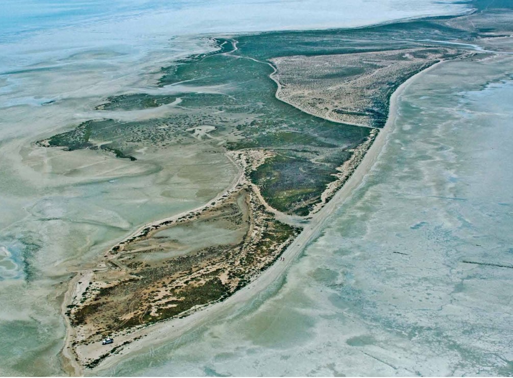
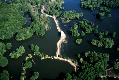
Remote sensing image application for mangrove management
Remote sensing application for measuring soil moisture and ocean salinity
SMOS represents a new measurement technique by applying a completely different approach in the field of earth observation from space. Satellite is capable of capturing both soil moisture and ocean salinity by capturing images of microwave radiation emitted around 1.4 GHz (L band). SMOS will bring the first interferometer radiometer, orbiting space, through space.
Soil moisture plays an important role in the global water cycle because it controls the growth of vegetation to a large extent. Because the data measuring soil moisture is very sparse, more data is needed if we better understand the cycle of seawater.
Ocean circulation plays an important role in regulating climate, for example, transporting heat from the equator to the poles. Therefore ocean salinity is one of the important variables to monitor and model ocean circulation.
In addition, satellite imagery has been used to survey and map the coastal strip sensitivity map for the purpose of preventing oil spill.
Thus, remote sensing photo application in environmental resources management is always the most practical and optimal plan to achieve the highest efficiency.
In addition, the application of remote sensing images in search and rescue on the sea accurately and efficiently.
Source:DigitalGlobe, GIS, cục viễn thám quốc gia, Landsat
Ngoc Hien

