
Remote sensing image application for climate change management helps identify changes, provides automated data sets for vegetation and uses land cover to monitor climate change by updating the proposed area. And incorporate more recent images to identify changes.

design consultancy and monitoring remote sensing services
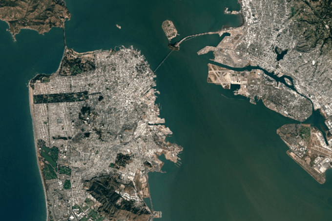
Remote sensing images analyze changes in the natural environment
Remote sensing image data is expected to contribute to a range of application areas related to global climate change for plant dynamics and ecosystems, risk and disaster monitoring, emergency management level, ground climate, hydrology and change of land cover.
Evaluating static properties of land cover (type, quantity and arrangement) and dynamic properties (type and rate of change) on remote sensing satellites can allow types to change areas chemistry and approximate sources of change are identified or deduced.
Remote sensing satellite image service
 Department of remote sensing images to reduce disaster risks
Remote sensing satellite imagery combined with GIS maps can provide managers and emergency officials with lots of information to assess and analyze natural hazards from small to large areas. across the globe.
Remote sensing image resolution
The spatial resolution of remote sensing image maps determines the ability to view individual features such as buildings and bridges. It also affects the ability to monitor and evaluate damage conditions, and depends on the nature of the hazard.
Using satellite image remote sensing monitoring terrain
Remote sensing image data is widely used to explain terrain types, to identify and describe their various hazards and control factors, to detect changes and assess hazards.
Remote sensing techniques greatly support the investigation of natural hazards, both on a local and regional scale. Images from remote sensing images provide an additional tool so that we can extract information about causes and dangerous incidents. Most importantly, the data greatly supports predicting future hazards, which is very important for people living in the area.

Remote sensing image survey
Application of remote sensing images in land management
Remote sensing images for measuring land cover, land use and changes are key to many diverse applications such as environment, forestry, hydrology, agriculture and geology. Natural resource management, planning and monitoring programs depend on accurate information on land cover in an area.
Remote sensing image processing process
Methods for monitoring vegetation change from intensive field sampling to batch inventory to extensive analysis of remotely perceived data have been proven to be more cost effective for large areas. , evaluate and analyze small websites.
Remote sensing image technology provides automatic satellite map data for the use of vegetation and land cover by updating your projected area and combining more recent images to determine changes. Evaluating static properties of land cover (type, quantity and arrangement) and dynamic properties (type and rate of change) on remote sensing image data can allow types to change areas chemistry and the approximate sources of change are determined.
Characteristics of optical remote sensing images
Furthermore, multilateral bands, which can provide increased spectral resolution, can be used to further analyze and classify environmental conditions, land cover and change detection, and urban development. Traffic related marketing and development affects these conditions.

Remote sensing images for environmental monitoring
Application of remote sensing images in environmental monitoring
Satellite Image Group (SIC) provides remote sensing data using a combination of color and multicolor bands to highlight the most important environmental features for your project.
Remote sensing image data serves life
Remote sensing images have greatly expanded the opportunities of integrating satellite data, analyzing, modeling and producing satellite maps for monitoring and evaluation. As the population increases, as countries boost their economies, as the landscape changes, the government increasingly relies on updated satellite imagery and other geospatial data for regulatory applications. planning, land registration, disaster response, public health, agricultural biodiversity, application of remote sensing images in the field of agriculture and forestry
High-resolution remote sensing photography has facilitated scientific research activities at landscape and area scales. The usability of remote sensing satellites can provide a resolution of 0.31m or better for analysis of urban growth and transport development for evaluation and monitoring.
Remote sensing image interpretation
Multi-sensor can provide increased spectral resolution that can be used to further analyze soil cover and change detection, and urban development and transport related development. How to these conditions.

Source: DigitalGlobe
Ngoc Hien