
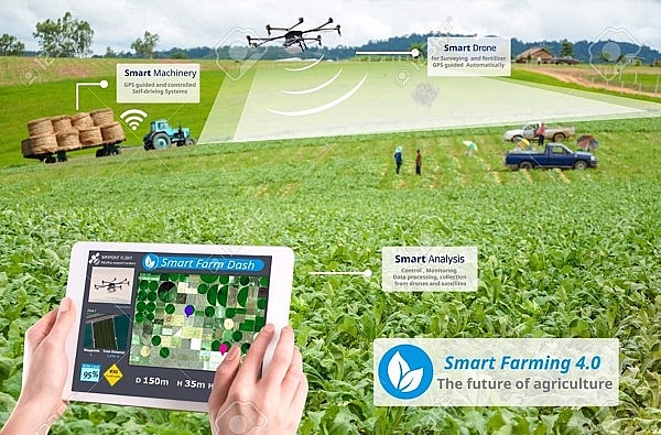
Application of remote sensing images in agricultural management, helping scientists accurately predict production, crops and disaster monitoring. Remote sensing imagery supports policy-making scientists to provide good solutions for the agricultural sector.
process of remote sensing video processing
Identify risks through remote sensing technology
Using photos taken from remote sensing are the preeminent factors that the agricultural industry can get when applying high technology in general, remote sensing technology in particular to production.
Actual use of remote sensing technology in Vietnam
Vietnam is a country with great potential for agricultural development, however, over the years, data on agricultural production has come to farmers, businesses, insurance organizations, and major planners. books and experts still have many limitations, leading to many risks in the agricultural sector.
And remote sensing technology (CNT) is one of the tools to achieve this requirement for the industry, helping agriculture reduce the difficulties facing today.
According to the Vietnam Institute for Agricultural Planning and Projection, aerospace technology allows monitoring and supervision, replacing the usual tools we are currently working on, can give better results with the same content required.
For example, in the past, Vietnam used a statistical system, taking a lot of time and big errors. The application of aerospace technology gives faster time, results on a wider area.
And in the testing process showed that the cost of using aerospace technology is lower to produce fast and accurate results according to management requirements …

Application of remote sensing images in practice
Comments on the role of science and technology in general, aerospace technology in particular for the agricultural sector, Associate Professor Dr. Pham Quang Ha, Institute of Agricultural Planning said, aerospace technology, with its accuracy will help much for monitoring. monitoring rice production for administration and food production planning; Assessing the extent of damage caused by natural disasters, insurance assistance to reduce risks for farmers; Supporting related fields such as statistics, food reserves, planning, climate change prevention, scientific research and teaching …
Prof. Dr. Pham Quang Ha cited, for example, the recent flood has caused many localities in the North to lose their rice crop. Farmers only knew their fields were damaged.
But to ask for support, what evidence confirms they have lost their seasons. Aerospace technology will be the tool to support them, assessing the extent of damage in districts and communes, and the smaller is how much the damage in the plots is the basis for the State as well as organizations. insurance provides support, minimizing difficulties for farmers.

Application of remote sensing images in land use
Tool to support remote sensing image processing
Sharing the strengths that remote sensing industry brings to agriculture, Mr. Nguyen Quang Dung, Director of the Institute of Agricultural Planning and Projection said, using satellite images, scientists will use signals provided by satellites in 6 or 12 day cycles. Thus, it is possible to clearly and accurately determine the start of the season.
Remote sensing data gives the most accurate results
Later, this data was included in the growth model and yielded estimates of rice yield with high accuracy and stability at 90-92%.
According to experts, aerospace technology, along with simulation technology and map technologies will help to provide information to forecast risks, which is also a picture to help state management agencies to support. support for damages (if any), or agricultural insurance agencies through those evidence to enable immediate support to farmers.
Mr. Marcel Reymond, Head of Development at the Swiss Embassy in Hanoi also appreciated the use of aerospace technology for agricultural production and support for agricultural insurance.
According to him, the coming trend of all agricultural products must be covered by insurance because this is a very high risk area for natural disasters. And aerospace technology will facilitate the deployment of agricultural insurance.
“Ensuring food security is an important issue for every country. This technology will help provide accurate, timely and objective data on rice production losses. At the same time, helping insurance companies solve the almost insurmountable barrier is the high transaction costs in insurance programs targeting small farmers, ”he said.
Source: nongnghiep, Ministry of NR&E
Synthetic/Ngọc Hiền