
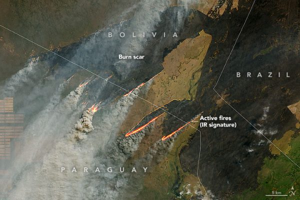
Remote sensing application is the most optimal solution in managing forest resources. At present, the state has applied the science of GIS technology and remote sensing images to monitor and monitor forests. Monitoring and warning of forest fires. Mapping of plant structure characteristics such as height, biomass, area of tree trunk, forest volume. Monitoring ground changes (Exploitation, destruction, reforestation).
Security – Defense
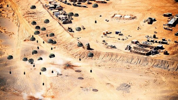
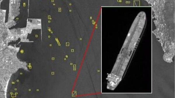
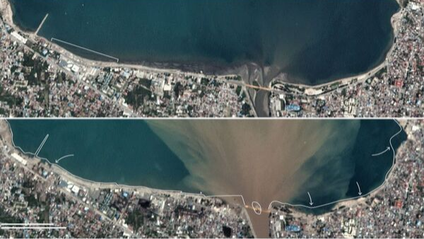
In the field of National Security, remote sensing images have applications: 2D, 3D topographic mapping. Monitoring the border and islands. Search and rescue at sea. Monitoring the accretion of islands … Monitoring Ship identification at sea. Support for infrastructure management planning. Monitoring the construction of the base …
Search and Rescue
Remote sensing application updates the location information where the incident occurred on the digital map. Update information of case type and situation. Update information of people, units and organizations informing. Update information on when or when the incident or situation is observed. Update other relevant information. Look up by type of case, situation.
Climate Changes
Remote sensing application combining GIS data to help identify climate change, GIS data provides automatic data sets for vegetation and land cover use to monitor climate change by updating Your expected areas and more recent image combinations to identify changes.
Resources and Environment
Selection of remote sensing technology is the most important priority solution in the construction of a system of Vietnamese marine environmental and hydro-meteorological monitoring stations, monitoring of land and water resources and management. the forest.

Infrastructure management
Remote sensing images and GIS data are indispensable in state management, the use of remote sensing images for urban planning and monitoring is the most optimal method, accurate measurement of data.
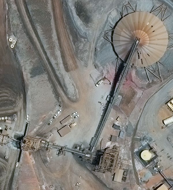
Energy
Remote sensing photo application plays a particularly important role in the observation and exploration of mineral deposits, determining the location of oil refining pipelines, detecting risks, creating the foundation for developing energy industries.
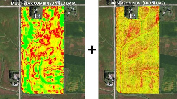
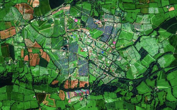
Agriculture
Remote sensing applications play a particularly important role in observing the change of vegetation, identifying farmland samples, monitoring crops and warning agricultural disasters.